In almost all cases, having an understanding of a project’s geographical location is critical in quantifying its impacts. Grid projects do not exist in a vacuum – they are intrinsically connected to the larger system. By targeting a region, the GridPIQ screening tool grounds the project impacts in its geographic and grid context, accounting for important factors such as regional weather patterns and generation mix.
GridPIQ leverages data from the Environmental Protection Agency’s (EPA) Avoided Emissions and Generation Tool (AVERT), which disaggregates the United States into ten different regions. Therefore, when fuel mix driven impacts are under investigation, users are asked to select the AVERT region that most appropriately describes where their project will be located.
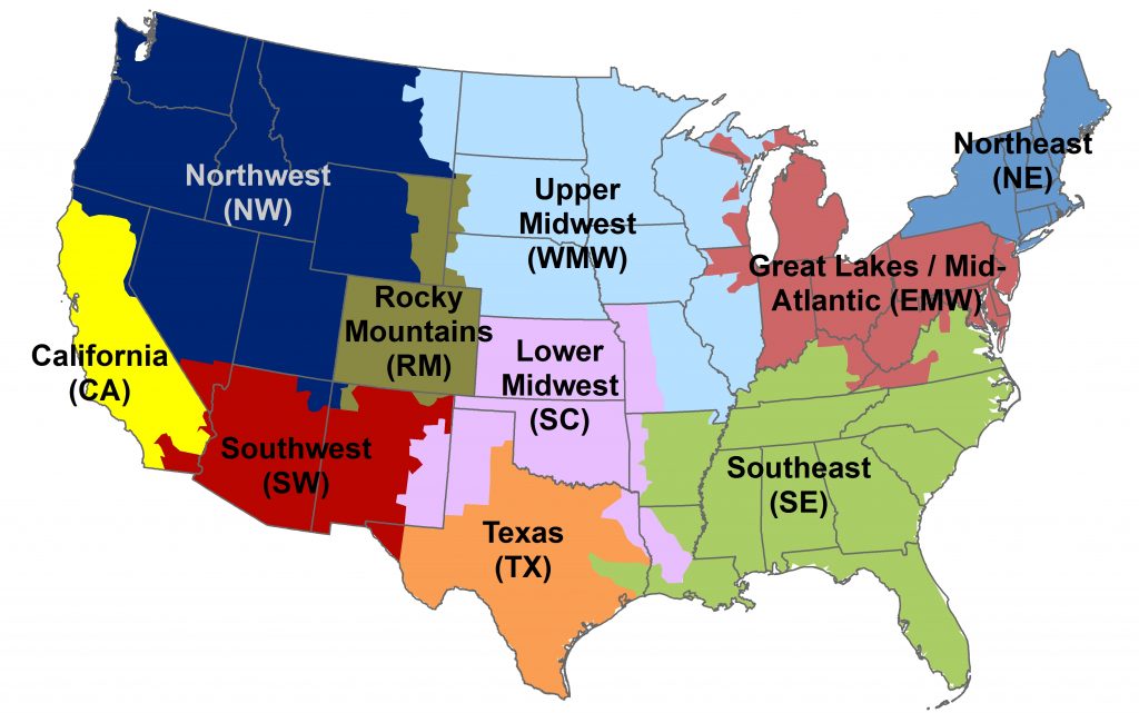
In addition to determining emissions data, the selection of an analysis region also informs the selection of line loss and fossil fuel cost data.
GridPIQ follows the EPA convention of dividing the bulk power system into these regions to reduce boundary issues across balancing areas, markets and interconnections.